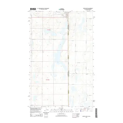
2014 Map of Westby South
USGS Topo · Published 2014About this map
Westby sits at the northern edge of this high plains landscape, positioned directly on the border where Montana and North Dakota meet. The township grid of t36n r58e and t35n r58e organizes a territory defined by numerous prairie potholes and seasonal water bodies, most notably Goose Lake. This 2014 survey documents the enduring agricultural and civic structure of the region, anchored by the town's street grid featuring W Northern Ave and Railroad Dr. Away from the central settlement, the map records essential local landmarks for family historians, including the Westby Cem and the more remote Daneville Cem to the southeast. A network of rural section-line roads, such as Scandia Rd and Lindell Rd, provides access to the surrounding farmsteads and the various marshes that punctuate the Sheridan County and Divide County borderlands.
Find a feature on this map
35 named features on this map. Tap any name to fly to it.
Don’t see what you’re looking for? This feature index may not catch every label — zoom into the map to look around manually.
Map Details
Editions of this 2014 Westby South Map
This is the sole edition of this map. No revisions or reprints were ever made.
Other maps of this area

1953 · Williston
USGS Topo · 1:250,000

1954 · Wolf Point
USGS Topo · 1:250,000

1957 · Williston
USGS Topo · 1:250,000

1958 · Wolf Point
USGS Topo · 1:250,000

1983 · Tadpole Lake
USGS Topo · 1:24,000

1983 · Lone Tree Lake
USGS Topo · 1:24,000
1983 · Coalridge
USGS Topo · 1:24,000

1983 · Westby South
USGS Topo · 1:24,000

1983 · Alkabo
USGS Topo · 1:24,000

1983 · Westby North
USGS Topo · 1:24,000