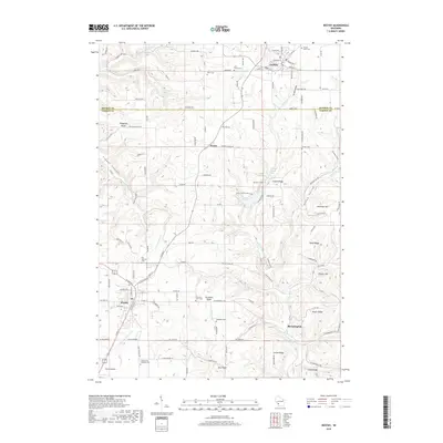
2018 Map of Westby
USGS Topo · Published 2018About this map
Westby and Cashton anchor this rural landscape in the Driftless Area, where the boundary between Monroe Co and Vernon Co follows the high ground of the ridge-and-valley terrain. The settlement pattern here is deeply tied to the topographic layout, with numerous family-named landmarks such as Goplin Ridge, Wang Ridge, and McElhose Hill defining the local geography. The area's heritage is visible through its many burial grounds, including the Coon Prairie Lutheran Cem and Sacred Heart Cem. Drainage is provided by a network of waterways like the W Fork Kickapoo River and Timber Coulee Cr, which carve out the coulees characteristic of this part of Wisconsin. Small unincorporated communities like Bloomingdale and Newry persist alongside agricultural fields and winding county roads, illustrating a resilient rural economy shaped by the underlying limestone geology.
Find a feature on this map
89 named features on this map. Tap any name to fly to it.
Don’t see what you’re looking for? This feature index may not catch every label — zoom into the map to look around manually.
Map Details
Editions of this 2018 Westby Map
This is the sole edition of this map. No revisions or reprints were ever made.
Other maps of this area

1909 · Sparta
USGS Topo · 1:62,500

1916 · Tomah
USGS Topo · 1:62,500

1923 · Viroqua
USGS Topo · 1:62,500

1926 · Viroqua
USGS Topo · 1:62,500

1926 · La Farge
USGS Topo · 1:62,500

1947 · Sparta
USGS Topo · 1:62,500

1949 · Sparta
USGS Topo · 1:62,500

1949 · Tomah
USGS Topo · 1:62,500

1958 · La Crosse
USGS Topo · 1:250,000

1961 · La Crosse
USGS Topo · 1:250,000