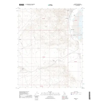
2018 Map of Westend
USGS Topo · Published 2018About this map
Argus and Borosolvay sit along the western edge of the dry lake beds in this 2018 survey of San Bernardino County. The map details a complex landscape where industrial and residential pockets like Westend and South Trona meet the stark desert terrain. To the west, the Argus Range rises sharply, while the southern reaches transition into the Mojave Desert near Fish Head Rocks. The intricate network of specialized infrastructure is evident in the inclusion of E Trona Rd and the proximity to both Searles Valley and Salt Wells Valley. This record captures the modern footprint of these high-desert communities, showing the persistence of settlements in a region defined by extreme topography and seasonal basins like Poison Canyon.
Find a feature on this map
28 named features on this map. Tap any name to fly to it.
Don’t see what you’re looking for? This feature index may not catch every label — zoom into the map to look around manually.
Map Details
Editions of this 2018 Westend Map
This is the sole edition of this map. No revisions or reprints were ever made.
Other maps of this area

1915 · Searles Lake
USGS Topo · 1:250,000

1947 · Trona
USGS Topo · 1:250,000

1948 · Trona
USGS Topo · 1:250,000

1949 · Trona
USGS Topo · 1:62,500

1949 · Searles Lake
USGS Topo · 1:62,500

1950 · Searles Lake
USGS Topo · 1:62,500

1950 · Trona
USGS Topo · 1:62,500

1953 · Mountain Springs Canyon
USGS Topo · 1:62,500

1953 · Ridgecrest
USGS Topo · 1:62,500

1953 · Trona
USGS Topo · 1:250,000