
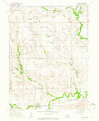
1961 Map of Western
USGS Topo · Published 1963About this map
The village of Western serves as the central hub of this early 1960s landscape, situated at the junction of the Chicago Burlington and Quincy railroad and the South Fork Swan Creek. The surrounding Saline County countryside is defined by its watercourses, with the North Fork Swan Creek and Spring Creek cutting through the terrain to the north. A local Quarry and scattered community landmarks like Swan Valley Sch illustrate the rural infrastructure of the era.
Find a feature on this map
15 named features on this map. Tap any name to fly to it.
Don’t see what you’re looking for? This feature index may not catch every label — zoom into the map to look around manually.
Map Details
Editions of this 1961 Western Map
This is the sole edition of this map. No revisions or reprints were ever made.
Other maps of this area

1935 · Dorchester
USGS Topo · 1:48,000

1940 · Dorchester
USGS Topo · 1:62,500

1955 · Lincoln
USGS Topo · 1:250,000

1957 · Lincoln
USGS Topo · 1:250,000

1958 · Lincoln
USGS Topo · 1:250,000

1960 · Western SW
USGS Topo · 1:24,000

1960 · Daykin
USGS Topo · 1:24,000

1961 · Tobias
USGS Topo · 1:24,000

1961 · Western SE
USGS Topo · 1:24,000
1961 · Swanton
USGS Topo · 1:24,000