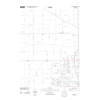
2013 Map of Westfield
USGS Topo · Published 2013About this map
Hortonville and Eagletown anchor this northern Hamilton County landscape, where the traditional agricultural grid meets the expanding suburban outskirts of the early twenty-first century. The area is defined by a dense network of watercourses, including Eagle Cr and its tributaries like Little Eagle Cr and Woodruff Br, which have shaped the drainage and development patterns of the region. This survey captures a transitional moment for small settlements such as Jolietville and Lamong, which remain situated along major section-line roads like W 206th St.
Find a feature on this map
151 named features on this map. Tap any name to fly to it.
Don’t see what you’re looking for? This feature index may not catch every label — zoom into the map to look around manually.
Map Details
Editions of this 2013 Westfield Map
This is the sole edition of this map. No revisions or reprints were ever made.
Other maps of this area

1952 · Fishers
USGS Topo · 1:24,000

1952 · Carmel
USGS Topo · 1:24,000

1953 · Westfield
USGS Topo · 1:24,000

1953 · Rosston
USGS Topo · 1:24,000

1953 · Zionsville
USGS Topo · 1:24,000

1953 · Noblesville
USGS Topo · 1:24,000

1953 · Danville
USGS Topo · 1:250,000

1953 · Indianapolis
USGS Topo · 1:250,000

1955 · Danville
USGS Topo · 1:250,000

1956 · Danville
USGS Topo · 1:250,000