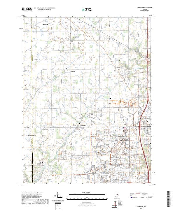
2022 Map of Westfield
USGS Topo · Published 2022About this map
Westfield and northern Carmel center this contemporary survey of Hamilton County, showcasing a landscape where historical Quaker roots meet modern suburban expansion. The map preserves the locations of numerous early burial grounds, including the Anti-Slavery Friends Cem and Greenwood Friends Cem, reflecting the area's deep abolitionist and religious heritage. The transition from rail to recreation is evident in the Monon Trl, which follows the former Monon Railroad corridor northward through Hortonville toward Sheridan.
Find a feature on this map
98 named features on this map. Tap any name to fly to it.
Don’t see what you’re looking for? This feature index may not catch every label — zoom into the map to look around manually.
Map Details
Editions of this 2022 Westfield Map
This is the sole edition of this map. No revisions or reprints were ever made.
Other maps of this area

1952 · Fishers
USGS Topo · 1:24,000

1952 · Carmel
USGS Topo · 1:24,000

1953 · Westfield
USGS Topo · 1:24,000

1953 · Rosston
USGS Topo · 1:24,000

1953 · Zionsville
USGS Topo · 1:24,000

1953 · Noblesville
USGS Topo · 1:24,000

1953 · Danville
USGS Topo · 1:250,000

1953 · Indianapolis
USGS Topo · 1:250,000

1955 · Danville
USGS Topo · 1:250,000

1956 · Danville
USGS Topo · 1:250,000