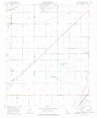
1956 Map of Westhaven
USGS Topo · Published 1977About this map
The vast agricultural and industrial grid of the San Joaquin Valley is defined by its rectilinear road network and the sprawling Lemoore Air Field at the northern edge of this survey. This landscape transition is marked by the Tulare Lake Bed in the southeast, where the terrain flattens toward the former lake floor. The region’s economic lifeblood is evident through the massive Southern Pacific rail line and numerous agricultural infrastructure points like the Allen Ranch and Boston Ranch.
Find a feature on this map
35 named features on this map. Tap any name to fly to it.
Don’t see what you’re looking for? This feature index may not catch every label — zoom into the map to look around manually.
Map Details
Editions of this 1956 Westhaven Map
4 editions found
Other maps of this area

1912 · Coalinga
USGS Topo · 1:125,000

1926 · Lethent
USGS Topo · 1:31,680

1927 · Lemoore
USGS Topo · 1:31,680

1929 · Stratford
USGS Topo · 1:31,680

1929 · Westhaven
USGS Topo · 1:31,680

1930 · Discovery Well
USGS Topo · 1:31,680

1932 · West of Lethent
USGS Topo · 1:31,680

1933 · Kettleman City
USGS Topo · 1:31,680

1933 · Huron
USGS Topo · 1:31,680

1933 · Chatom Ranch
USGS Topo · 1:31,680