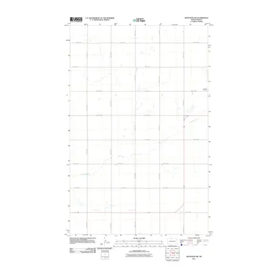
2011 Map of Westhope SW
USGS Topo · Published 2011About this map
The Week Cemetery sits near the eastern edge of this landscape, a lone landmark in the open agricultural plains of Bottineau County. The area is defined by a rigorous township-and-range grid, with gravel and paved roads such as 22nd Ave NW and 95th St NW forming the primary transportation network across the prairie. Small prairie potholes and drainage basins are scattered throughout the sections, reflecting the natural hydrography of the northern plains. Near the southern border, County Rd-17B provides a more significant thoroughfare, connecting the local grid to the broader region. This 2011 survey illustrates the persistent rural character and large-scale farming patterns of the North Dakota borderlands during the early twenty-first century.
Find a feature on this map
15 named features on this map. Tap any name to fly to it.
Don’t see what you’re looking for? This feature index may not catch every label — zoom into the map to look around manually.
Map Details
Editions of this 2011 Westhope SW Map
This is the sole edition of this map. No revisions or reprints were ever made.
Other maps of this area

1948 · Lansford
USGS Topo · 1:62,500

1949 · Lansford NE
USGS Topo · 1:24,000

1949 · Maxbass
USGS Topo · 1:24,000

1949 · Eckman
USGS Topo · 1:24,000

1949 · Westhope SW
USGS Topo · 1:24,000

1950 · Lansford
USGS Topo · 1:62,500

1950 · Westhope SW
USGS Topo · 1:24,000

1950 · Antler
USGS Topo · 1:24,000
1950 · Renville
USGS Topo · 1:24,000

1951 · Westhope SE
USGS Topo · 1:24,000