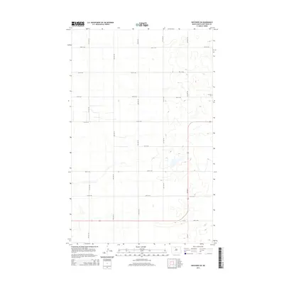
2014 Map of Westhope SW
USGS Topo · Published 2014About this map
The sprawling section-line grid of Bottineau County dominates this landscape just south of the Canadian border. The terrain is defined by numerous small depressions and seasonal wetlands characteristic of the northern plains, carved through by the rectilinear path of local thoroughfares like 100th St NW and 24th Ave NW. This survey documents a sparsely populated agricultural region where the primary landmarks are those connected to the earliest homesteading families. A significant local landmark is The Week Cem, situated near the intersection of 98th St NW and 20th Ave NW. In the southern portion of the quadrangle, the road network shifts with the introduction of Cr-17b and Cmc 0517, providing essential transit links across the rural prairie.
Find a feature on this map
17 named features on this map. Tap any name to fly to it.
Don’t see what you’re looking for? This feature index may not catch every label — zoom into the map to look around manually.
Map Details
Editions of this 2014 Westhope SW Map
This is the sole edition of this map. No revisions or reprints were ever made.
Other maps of this area

1948 · Lansford
USGS Topo · 1:62,500

1949 · Lansford NE
USGS Topo · 1:24,000

1949 · Maxbass
USGS Topo · 1:24,000

1949 · Eckman
USGS Topo · 1:24,000

1949 · Westhope SW
USGS Topo · 1:24,000

1950 · Lansford
USGS Topo · 1:62,500

1950 · Westhope SW
USGS Topo · 1:24,000

1950 · Antler
USGS Topo · 1:24,000
1950 · Renville
USGS Topo · 1:24,000

1951 · Westhope SE
USGS Topo · 1:24,000