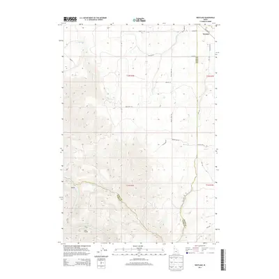
2013 Map of Westlake
USGS Topo · Published 2013About this map
The Salmon River carves a dramatic path through the southwest corner of this Idaho landscape, featuring the notable Snow Hole Rapids and the depth of Long Canyon. This area, situated along the border of Lewis and Idaho Counties, showcases a rural transition from high-plateau agriculture to steep river breaks. The settlement of Westlake sits near the northern boundary, connected to the surrounding countryside by a network of named tracks like Haas Ranch Rd and Keuterville Rd.
Find a feature on this map
28 named features on this map. Tap any name to fly to it.
Don’t see what you’re looking for? This feature index may not catch every label — zoom into the map to look around manually.
Map Details
Editions of this 2013 Westlake Map
This is the sole edition of this map. No revisions or reprints were ever made.
Other maps of this area

1924 · Kamiah
USGS Topo · 1:125,000

1955 · Pullman
USGS Topo · 1:250,000

1955 · Grangeville
USGS Topo · 1:250,000

1958 · Pullman
USGS Topo · 1:250,000

1959 · Grangeville
USGS Topo · 1:250,000

1963 · Boles
USGS Topo · 1:24,000

1963 · Rattlesnake Ridge
USGS Topo · 1:24,000

1963 · Moughmer Point
USGS Topo · 1:24,000

1967 · Craigmont
USGS Topo · 1:24,000

1967 · Hoover Point
USGS Topo · 1:24,000