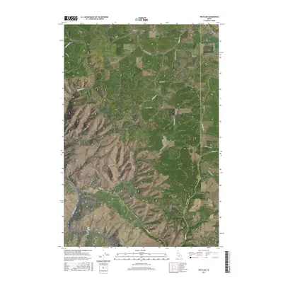
2017 Map of Westlake
USGS Topo · Published 2017About this map
Westlake sits at the intersection of the Camas Prairie's high agricultural plateaus and the dramatic descent into the Salmon River canyon system. This modern topographic survey reveals a landscape shaped by both water and historical transit, most notably the path of an Old Railroad Grade that winds through the northern sections near Willow Creek. To the southwest, the terrain drops sharply toward the river, where Long Canyon and Deep Creek carve through the breaks. The water-carved geography is punctuated by specific river features like Shoe Hole Rapids and the bend at Oxbow, highlighting the complex topography that defines the border between Lewis and Idaho counties. Local transit and ranching history are preserved in the naming of rural routes such as Haas Ranch Rd and Hussman Mill Rd, which provide context for the scattered settlements and farmsteads found throughout this high-elevation region.
Find a feature on this map
28 named features on this map. Tap any name to fly to it.
Don’t see what you’re looking for? This feature index may not catch every label — zoom into the map to look around manually.
Map Details
Editions of this 2017 Westlake Map
This is the sole edition of this map. No revisions or reprints were ever made.
Other maps of this area

1924 · Kamiah
USGS Topo · 1:125,000

1955 · Pullman
USGS Topo · 1:250,000

1955 · Grangeville
USGS Topo · 1:250,000

1958 · Pullman
USGS Topo · 1:250,000

1959 · Grangeville
USGS Topo · 1:250,000

1963 · Boles
USGS Topo · 1:24,000

1963 · Rattlesnake Ridge
USGS Topo · 1:24,000

1963 · Moughmer Point
USGS Topo · 1:24,000

1967 · Craigmont
USGS Topo · 1:24,000

1967 · Hoover Point
USGS Topo · 1:24,000