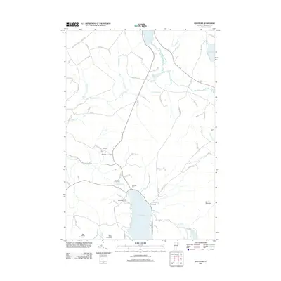
2012 Map of Westmore
USGS Topo · Published 2012About this map
Lake Willoughby dominates the southern portion of this Orleans County survey, its shoreline dotted with local landmarks like Songadeewin Camp and Lakeview Cem. The landscape reflects a mix of seasonal recreation and established rural settlements, with Westmore situated near the lake's eastern edge and East Brownington to the northwest. Waterways such as the Clyde River and the Willoughby River connect several smaller bodies of water, including Pensioner Pond and Toad Pond. The map also reveals the locations of several burial grounds essential for genealogical research, including Blyhill Cem and the East Brownington Cem. Numerous family-named roads like Bly Farm Rd and George Cole Rd provide clues to historical land ownership throughout the hills surrounding May Pond Mountain and Goodwin Mountain.
Find a feature on this map
86 named features on this map. Tap any name to fly to it.
Don’t see what you’re looking for? This feature index may not catch every label — zoom into the map to look around manually.
Map Details
Editions of this 2012 Westmore Map
This is the sole edition of this map. No revisions or reprints were ever made.
Other maps of this area

1919 · Lake Memphremagog
USGS Topo · 1:62,500

1920 · Derby
USGS Topo · 1:62,500

1923 · Lake Memphremagog
USGS Topo · 1:48,000

1924 · Island Pond
USGS Topo · 1:48,000

1925 · Memphremagog
USGS Topo · 1:62,500

1926 · Island Pond
USGS Topo · 1:62,500

1935 · Lyndonville
USGS Topo · 1:48,000

1939 · Lyndonville
USGS Topo · 1:62,500

1950 · Lake Champlain
USGS Topo · 1:250,000

1950 · Lewiston
USGS Topo · 1:250,000