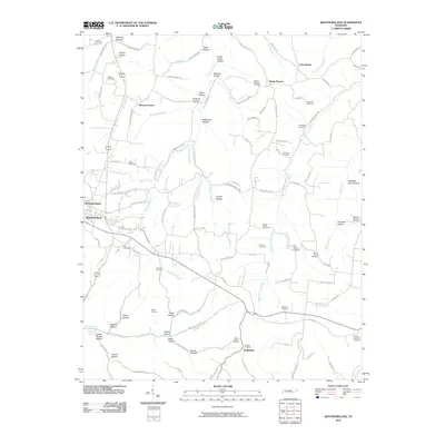
2010 Map of Westmoreland
USGS Topo · Published 2010About this map
Pleasant Grove and Westmoreland anchor this part of northern Sumner County, where the Highland Rim's dissection creates a dense network of naming. The landscape is defined by its deep hollows, many carrying the names of families who settled the region, such as Sugar Camp Hollow, Hoskins Hollow, and Stillhouse Hollow. This 2010 survey reveals a community deeply rooted in its geography, with more than a dozen burial grounds including Love-Ladd Cemetery and the Millers Chapel Cemetery scattered across the ridges. Water drainage patterns are intricate, with headwaters of Bledsoe Creek and the West Fork Long Creek carving through the terrain. The presence of Saltpeter Cave Hollow suggests the natural geological formations that influenced early local activity. Throughout the quadrangle, old road names like E Garretts Creek Rd and Poplar Grove Rd connect small crossroads like Rocky Mound and Fairview.
Find a feature on this map
112 named features on this map. Tap any name to fly to it.
Don’t see what you’re looking for? This feature index may not catch every label — zoom into the map to look around manually.
Map Details
Editions of this 2010 Westmoreland Map
This is the sole edition of this map. No revisions or reprints were ever made.
Other maps of this area

1928 · Adolphus
USGS Topo · 1:48,000

1931 · Lafayette
USGS Topo · 1:62,500

1931 · Adolphus
USGS Topo · 1:62,500

1942 · Gallatin
USGS Topo · 1:100,000

1954 · Petroleum
USGS Topo · 1:24,000

1954 · Holland
USGS Topo · 1:24,000

1954 · Adolphus
USGS Topo · 1:24,000

1955 · Bethpage
USGS Topo · 1:24,000

1956 · Nashville
USGS Topo · 1:250,000

1958 · Westmoreland
USGS Topo · 1:24,000