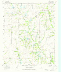
1961 Map of Weston
USGS Topo · Published 1975About this map
Weston and Chambersville anchor this northern Collin County landscape during a period of steady agricultural use and early water management. The terrain is defined by the winding East Fork Trinity River and its numerous tributaries, including Honey Creek and Wilson Creek. Several small community centers like Roland and Rhea Mills are visible, alongside scattered rural landmarks that speak to the area's pioneer heritage.
Find a feature on this map
24 named features on this map. Tap any name to fly to it.
Don’t see what you’re looking for? This feature index may not catch every label — zoom into the map to look around manually.
Map Details
Editions of this 1961 Weston Map
2 editions found
Other maps of this area

1929 · Frisco
USGS Topo · 1:62,500

1929 · McKinney
USGS Topo · 1:62,500

1954 · Sherman
USGS Topo · 1:250,000

1958 · Sherman
USGS Topo · 1:250,000

1960 · Frisco
USGS Topo · 1:24,000

1960 · McKinney East
USGS Topo · 1:24,000

1960 · Celina
USGS Topo · 1:24,000
1960 · McKinney West
USGS Topo · 1:24,000

1961 · Gunter
USGS Topo · 1:24,000

1961 · Van Alstyne
USGS Topo · 1:24,000