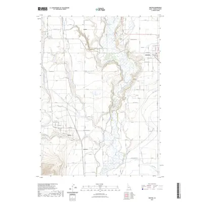
2023 Map of Weston
USGS Topo · Published 2023About this map
Franklin County's irrigation and settlement patterns are clearly defined in this modern survey of the Cache Valley area. The Preston townsite serves as a regional hub, anchored by the Franklin County Courthouse and the nearby Preston Airport. The landscape is intricately managed by a complex network of waterways, including the West Cache Canal, Twin Lakes Canal East Lateral, and Twin Lakes Canal West Lateral, which draw from the central Bear River corridor. These canals are vital to the agricultural character of the settlements at Weston, Dayton, and the small community at Anderson. Local history is preserved at the Weston Cem and Dayton Cem, while features like Weston Creek and Fivemile Creek trace the natural drainage of the valley floor.
Find a feature on this map
68 named features on this map. Tap any name to fly to it.
Don’t see what you’re looking for? This feature index may not catch every label — zoom into the map to look around manually.
Map Details
Editions of this 2023 Weston Map
This is the sole edition of this map. No revisions or reprints were ever made.
Other maps of this area

1914 · Logan
USGS Topo · 1:125,000

1915 · Preston
USGS Topo · 1:96,000

1916 · Logan
USGS Topo · 1:125,000

1918 · Preston
USGS Topo · 1:125,000

1954 · Pocatello
USGS Topo · 1:250,000

1954 · Ogden
USGS Topo · 1:250,000

1954 · Brigham City
USGS Topo · 1:250,000

1955 · Preston
USGS Topo · 1:250,000

1958 · Ogden
USGS Topo · 1:250,000

1958 · Pocatello
USGS Topo · 1:250,000