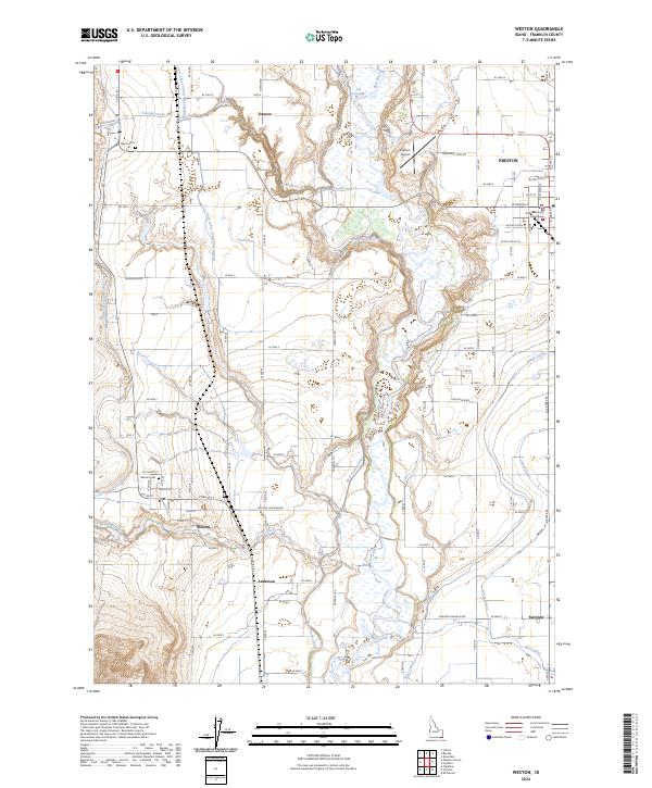
2024 Map of Weston
USGS Topo · Published 2024About this map
The Bear River carves a deep valley through this portion of Franklin County, defining a landscape shaped by early 21st-century irrigation and agriculture. To the west, the settlements of Weston and Dayton serve as local hubs, each maintaining dedicated burial grounds at Weston Cem and Dayton Cem. The presence of the Franklin County Courthouse in Preston underscores the area's importance as a civic center for the surrounding rural communities.
Find a feature on this map
61 named features on this map. Tap any name to fly to it.
Don’t see what you’re looking for? This feature index may not catch every label — zoom into the map to look around manually.
Map Details
Editions of this 2024 Weston Map
This is the sole edition of this map. No revisions or reprints were ever made.
Other maps of this area

1914 · Logan
USGS Topo · 1:125,000

1915 · Preston
USGS Topo · 1:96,000

1916 · Logan
USGS Topo · 1:125,000

1918 · Preston
USGS Topo · 1:125,000

1954 · Pocatello
USGS Topo · 1:250,000

1954 · Ogden
USGS Topo · 1:250,000

1954 · Brigham City
USGS Topo · 1:250,000

1955 · Preston
USGS Topo · 1:250,000

1958 · Ogden
USGS Topo · 1:250,000

1958 · Pocatello
USGS Topo · 1:250,000