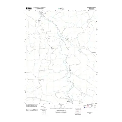
2010 Map of Westover
USGS Topo · Published 2010About this map
Chest Creek carves a winding path through this portion of Clearfield County, anchoring a series of small riverside settlements including Mahaffey, Newburg, and Westover. The landscape is defined by the heavy dissection of numerous tributaries like Snyder Run and Kings Run, which separate the uplands where New Washington and Thompsontown are situated. Local history and genealogy are well-represented by several family-named burial grounds, including the Cross Cemetery in the northeast and the Mahaffey Cemetery to the north. A notable local landmark, the Mahaffey Racetrack, sits just outside the town, while the LaJose Post Office serves the community of Newburg. The road network, including the named Five Points Rd and Bethlehem Hill Rd, reflects a rural infrastructure built around the topography of the creek valley and its surrounding ridges.
Find a feature on this map
66 named features on this map. Tap any name to fly to it.
Don’t see what you’re looking for? This feature index may not catch every label — zoom into the map to look around manually.
Map Details
Editions of this 2010 Westover Map
This is the sole edition of this map. No revisions or reprints were ever made.
Other maps of this area

1902 · Patton
USGS Topo · 1:62,500

1902 · Barnesboro
USGS Topo · 1:62,500

1903 · Curwensville
USGS Topo · 1:62,500

1904 · Barnesboro
USGS Topo · 1:62,500

1904 · Patton
USGS Topo · 1:62,500

1906 · Punxsutawney
USGS Topo · 1:62,500

1939 · Curwensville
USGS Topo · 1:62,500

1939 · Punxsutawney
USGS Topo · 1:62,500

1942 · Curwensville
USGS Topo · 1:62,500

1942 · Punxsutawney
USGS Topo · 1:62,500