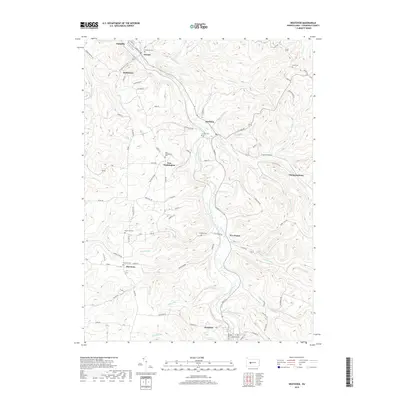
2019 Map of Westover
USGS Topo · Published 2019About this map
Chest Creek carves a central path through this section of Clearfield County, anchoring a series of small settlements and rural homesteads. The borough of Westover sits at the southern reach of the creek, while Mahaffey and Ostend occupy the northern landscape. This 2019 survey documents a region deeply connected to its local heritage, evidenced by the high concentration of family and community burial grounds including Westover Cem, New Washington Cem, and La Jose Cem.
Find a feature on this map
74 named features on this map. Tap any name to fly to it.
Don’t see what you’re looking for? This feature index may not catch every label — zoom into the map to look around manually.
Map Details
Editions of this 2019 Westover Map
This is the sole edition of this map. No revisions or reprints were ever made.
Other maps of this area

1902 · Patton
USGS Topo · 1:62,500

1902 · Barnesboro
USGS Topo · 1:62,500

1903 · Curwensville
USGS Topo · 1:62,500

1904 · Barnesboro
USGS Topo · 1:62,500

1904 · Patton
USGS Topo · 1:62,500

1906 · Punxsutawney
USGS Topo · 1:62,500

1939 · Curwensville
USGS Topo · 1:62,500

1939 · Punxsutawney
USGS Topo · 1:62,500

1942 · Curwensville
USGS Topo · 1:62,500

1942 · Punxsutawney
USGS Topo · 1:62,500