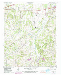
1959 Map of Westover
USGS Topo · Published 1990About this map
Agricultural lands and small crossroads communities characterize this 1959 survey of western Madison County, where the rural landscape is defined by its churches, schools, and stream networks. The Gulf Mobile And Ohio Railroad cuts diagonally through the terrain, serving small rural junctions like Neely and passing near the Denmark settlement. Education and faith were central to the area's development, evidenced by the distribution of local institutions such as Upper Ingram Sch, Oak Grove Ch, and Blairs Chapel.
Find a feature on this map
68 named features on this map. Tap any name to fly to it.
Don’t see what you’re looking for? This feature index may not catch every label — zoom into the map to look around manually.
Map Details
Editions of this 1959 Westover Map
3 editions found
Other maps of this area

1950 · Jackson South
USGS Topo · 1:24,000

1950 · Jackson North
USGS Topo · 1:24,000

1951 · Jackson North
USGS Topo · 1:24,000

1956 · Blytheville
USGS Topo · 1:250,000

1959 · Blytheville
USGS Topo · 1:250,000

1959 · Bells
USGS Topo · 1:24,000

1959 · Westover
USGS Topo · 1:24,000

1959 · Denmark
USGS Topo · 1:24,000

1959 · Adair
USGS Topo · 1:24,000

1961 · Medon
USGS Topo · 1:24,000