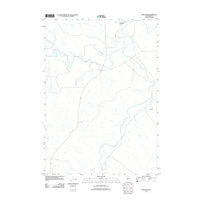
2012 Map of Westover
USGS Topo · Published 2012About this map
The confluence of the White River and Little White River dominates this portion of Mellette County, where the meandering waterways carve through the South Dakota landscape. Near the northern boundary, the settlement of Westover sits along the riverbanks, serving as a focal point in a region defined by its drainage basins and rural road networks. Further south, the Saint Phillip Cem offers a point of interest for genealogists tracing family histories in this part of the Swift Bear Segment. The topography is shaped by several tributaries, including Cottonwood Cr, Ash Cr, and Horse Cr, which feed into the larger river systems. Transportation in the early 21st century relied on a grid of local routes such as Jones Co Hwy 58 and Co Rd S6, providing access to the isolated homesteads and pastures characteristic of the Great Plains.
Find a feature on this map
9 named features on this map. Tap any name to fly to it.
Don’t see what you’re looking for? This feature index may not catch every label — zoom into the map to look around manually.
Map Details
Editions of this 2012 Westover Map
This is the sole edition of this map. No revisions or reprints were ever made.
Other maps of this area

1951 · Murdo SE
USGS Topo · 1:24,000

1951 · White River NE
USGS Topo · 1:24,000

1951 · Westover
USGS Topo · 1:24,000

1951 · Murdo SW
USGS Topo · 1:24,000

1951 · Murdo 3 NE
USGS Topo · 1:24,000

1951 · Okaton SE
USGS Topo · 1:24,000

1955 · Martin
USGS Topo · 1:250,000

1958 · Martin
USGS Topo · 1:250,000

1982 · White River SE
USGS Topo · 1:24,000

1982 · White River East
USGS Topo · 1:24,000