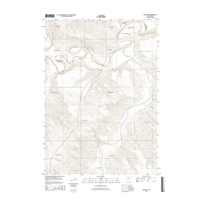
2015 Map of Westover
USGS Topo · Published 2015About this map
The White River and Little White River converge in this section of Mellette and Jones counties, carving a complex landscape of sharp ridges and winding waterways. The small settlement of Westover sits near the northern boundary, where the river's path creates distinct geographical features like Horseshoe Lake and the mouth of Ash Cr. The area is defined by its rural connectivity, with named routes such as Two Kettle Rd and Little White River Rd following the natural contours of the river valleys.
Find a feature on this map
24 named features on this map. Tap any name to fly to it.
Don’t see what you’re looking for? This feature index may not catch every label — zoom into the map to look around manually.
Map Details
Editions of this 2015 Westover Map
This is the sole edition of this map. No revisions or reprints were ever made.
Other maps of this area

1951 · Murdo SE
USGS Topo · 1:24,000

1951 · White River NE
USGS Topo · 1:24,000

1951 · Westover
USGS Topo · 1:24,000

1951 · Murdo SW
USGS Topo · 1:24,000

1951 · Murdo 3 NE
USGS Topo · 1:24,000

1951 · Okaton SE
USGS Topo · 1:24,000

1955 · Martin
USGS Topo · 1:250,000

1958 · Martin
USGS Topo · 1:250,000

1982 · White River SE
USGS Topo · 1:24,000

1982 · White River East
USGS Topo · 1:24,000