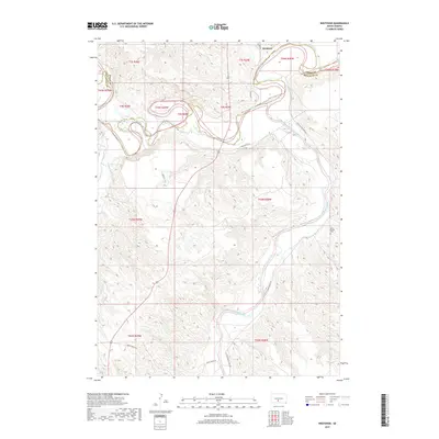
2017 Map of Westover
USGS Topo · Published 2017About this map
Westover sits at the confluence where Ash Cr meets the winding White River, a landscape defined by the deep incisions of water through the South Dakota plains. This 2017 survey captures the rural character of the Swift Bear Segment, where the Jones Co and Mellette Co line crosses the river valley. The topography is dominated by the sprawling drainage network of the Little White River, which snakes through the southern and eastern portions of the quadrangle. Local transportation follows the contours of the breaks and ridges, with routes like Two Kettle Rd, Gusty Ridge Rd, and Little White River Rd providing access to this isolated terrain. For those tracing local heritage, the Saint Phillip Cem stands as a primary landmark in the southeastern hills, overlooking the valley of the Little White River near the edge of the survey area.
Find a feature on this map
22 named features on this map. Tap any name to fly to it.
Don’t see what you’re looking for? This feature index may not catch every label — zoom into the map to look around manually.
Map Details
Editions of this 2017 Westover Map
This is the sole edition of this map. No revisions or reprints were ever made.
Other maps of this area

1951 · Murdo SE
USGS Topo · 1:24,000

1951 · White River NE
USGS Topo · 1:24,000

1951 · Westover
USGS Topo · 1:24,000

1951 · Murdo SW
USGS Topo · 1:24,000

1951 · Murdo 3 NE
USGS Topo · 1:24,000

1951 · Okaton SE
USGS Topo · 1:24,000

1955 · Martin
USGS Topo · 1:250,000

1958 · Martin
USGS Topo · 1:250,000

1982 · White River SE
USGS Topo · 1:24,000

1982 · White River East
USGS Topo · 1:24,000