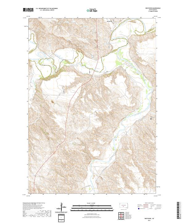
2021 Map of Westover
USGS Topo · Published 2021About this map
Westover stands at the northern edge of this South Dakota landscape, where the meandering course of the White River meets the drainages of Ash Cr and Horse Cr. The topography is defined by the sharp dissected breaks and ridges typical of the region, specifically around the confluence where the Little White River winds northward to join the main channel. The map reveals a remote pastoral setting, with the Mellette and Jones county line weaving across the river valley, marking a transition between high tablelands and eroded river bottoms.
Find a feature on this map
24 named features on this map. Tap any name to fly to it.
Don’t see what you’re looking for? This feature index may not catch every label — zoom into the map to look around manually.
Map Details
Editions of this 2021 Westover Map
This is the sole edition of this map. No revisions or reprints were ever made.
Other maps of this area

1951 · Murdo SE
USGS Topo · 1:24,000

1951 · White River NE
USGS Topo · 1:24,000

1951 · Westover
USGS Topo · 1:24,000

1951 · Murdo SW
USGS Topo · 1:24,000

1951 · Murdo 3 NE
USGS Topo · 1:24,000

1951 · Okaton SE
USGS Topo · 1:24,000

1955 · Martin
USGS Topo · 1:250,000

1958 · Martin
USGS Topo · 1:250,000

1982 · White River SE
USGS Topo · 1:24,000

1982 · White River East
USGS Topo · 1:24,000