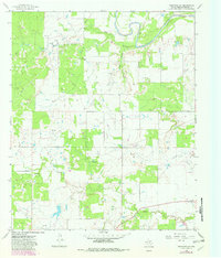
1966 Map of Westover SE
USGS Topo · Published 1982About this map
The Brazos River snakes through the northern reaches of this Throckmorton County landscape, defining a terrain shaped by both natural drainage and mid-century industrial development. The small settlement of Elbert sits at the eastern edge, serving as a focal point in a region primarily dedicated to petroleum extraction. This survey reveals a dense network of energy infrastructure, highlighted by the Lendra Oil Field and Travis Oil Field, with numerous Oil Wells and a prominent Pipeline cutting across the topography. The local hydrology is well-defined by seasonal drainages like Hog Creek, Coon Hollow, and Boggy Creek, which channel water toward the Brazos. This 1966 documentation, updated with 1981 revisions, illustrates the persistent footprint of the oil industry on the Texas ranchlands before more modern land-use changes altered the distribution of woodlots and equipment.
Find a feature on this map
12 named features on this map. Tap any name to fly to it.
Don’t see what you’re looking for? This feature index may not catch every label — zoom into the map to look around manually.
Map Details
Editions of this 1966 Westover SE Map
2 editions found
Other maps of this area

1954 · Wichita Falls
USGS Topo · 1:250,000

1958 · Wichita Falls
USGS Topo · 1:250,000

1963 · Megargel
USGS Topo · 1:24,000

1964 · Padgett
USGS Topo · 1:24,000

1965 · Throckmorton NE
USGS Topo · 1:24,000

1966 · Westover SE
USGS Topo · 1:24,000

1966 · Rock Canyon
USGS Topo · 1:24,000

1966 · Westover SW
USGS Topo · 1:24,000
1966 · Throckmorton
USGS Topo · 1:24,000
1966 · Westover
USGS Topo · 1:24,000