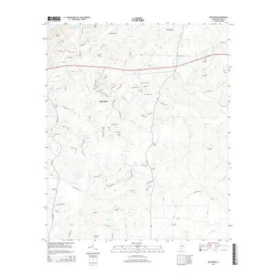
2014 Map of Westover
USGS Topo · Published 2014About this map
Chelsea and Westover occupy a landscape defined by the ridgelines of Double Mountain and Straight Ridge, where the residential growth of Shelby County meets the traditional geography of Alabama's Ridge-and-Valley region. The map reveals a dense network of country cemeteries, such as Union Cem and Mt Signal Cem, which serve as primary anchors for genealogical research in this area. These sites, along with others like Quinn Cem and Roper Cem, are often the only remaining physical links to the earlier family settlements that preceded modern development.
Find a feature on this map
107 named features on this map. Tap any name to fly to it.
Don’t see what you’re looking for? This feature index may not catch every label — zoom into the map to look around manually.
Map Details
Editions of this 2014 Westover Map
This is the sole edition of this map. No revisions or reprints were ever made.
Other maps of this area

1890 · Bessemer
USGS Topo · 1:125,000

1890 · Talladega
USGS Topo · 1:125,000

1892 · Talladega
USGS Topo · 1:125,000

1892 · Bessemer
USGS Topo · 1:125,000

1906 · Vandiver
USGS Topo · 1:62,500

1908 · Vandiver
USGS Topo · 1:62,500

1909 · Columbiana
USGS Topo · 1:62,500

1911 · Columbiana
USGS Topo · 1:62,500

1915 · Gantts Quarry
USGS Topo · 1:48,000

1917 · Gantts Quarry
USGS Topo · 1:62,500