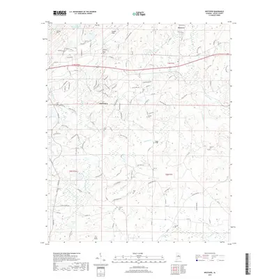
2018 Map of Westover
USGS Topo · Published 2018About this map
Chelsea and Westover occupy a landscape defined by the ridgelines of Pine Mtn and Straight Ridge, where suburban expansion meets the winding tributaries of Yellowleaf Cr. This modern topography shows a dense network of residential development, yet it remains anchored by a high concentration of family and community burial grounds, such as Quinn Cem and Mount Signal Cem. The map reveals how the modern road network, including Co Rd 280, follows the natural contours established by the local hills and creek basins. Small water bodies like Hargis Lake and Caldwell Lake punctuate the terrain, while specialized facilities like the Tri-L Acres Airpark and the Chelsea Game Preserve indicate the diverse land use in this part of Shelby County. Local landmarks like Teague Bridge and the Cahaba Girl Scout Council Lake provide specific points of interest for those tracing the recent geographic evolution of the region.
Find a feature on this map
119 named features on this map. Tap any name to fly to it.
Don’t see what you’re looking for? This feature index may not catch every label — zoom into the map to look around manually.
Map Details
Editions of this 2018 Westover Map
This is the sole edition of this map. No revisions or reprints were ever made.
Other maps of this area

1890 · Bessemer
USGS Topo · 1:125,000

1890 · Talladega
USGS Topo · 1:125,000

1892 · Talladega
USGS Topo · 1:125,000

1892 · Bessemer
USGS Topo · 1:125,000

1906 · Vandiver
USGS Topo · 1:62,500

1908 · Vandiver
USGS Topo · 1:62,500

1909 · Columbiana
USGS Topo · 1:62,500

1911 · Columbiana
USGS Topo · 1:62,500

1915 · Gantts Quarry
USGS Topo · 1:48,000

1917 · Gantts Quarry
USGS Topo · 1:62,500