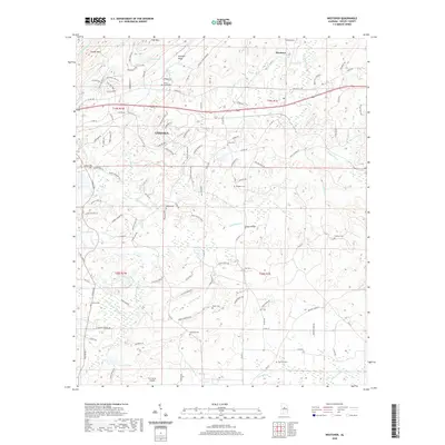
2020 Map of Westover
USGS Topo · Published 2020About this map
Chelsea and Westover anchor this Shelby County landscape, where modern residential development meets the steep relief of Pine Mountain and Double Mountain. The area is notably dense with small family and community burial grounds, including the Mount Signal Cemetery and Quinn Cemetery, suggesting a deep-rooted lineage of early homesteads along the creek valleys. A network of waterways, including Yellowleaf Creek and its many forks like North Fork Yellowleaf Creek, defines the drainage patterns between Straight Ridge and the southern lowland reaches. Transport infrastructure is represented by the CSX rail line and Teague Bridge, while the Tri-L Acres Airpark and Chelsea Game Preserve reflect more recent land-use transitions. This survey captures a mix of longstanding rural landmarks and the expanding footprint of highway-oriented growth near County Road 280.
Find a feature on this map
121 named features on this map. Tap any name to fly to it.
Don’t see what you’re looking for? This feature index may not catch every label — zoom into the map to look around manually.
Map Details
Editions of this 2020 Westover Map
This is the sole edition of this map. No revisions or reprints were ever made.
Other maps of this area

1890 · Bessemer
USGS Topo · 1:125,000

1890 · Talladega
USGS Topo · 1:125,000

1892 · Talladega
USGS Topo · 1:125,000

1892 · Bessemer
USGS Topo · 1:125,000

1906 · Vandiver
USGS Topo · 1:62,500

1908 · Vandiver
USGS Topo · 1:62,500

1909 · Columbiana
USGS Topo · 1:62,500

1911 · Columbiana
USGS Topo · 1:62,500

1915 · Gantts Quarry
USGS Topo · 1:48,000

1917 · Gantts Quarry
USGS Topo · 1:62,500