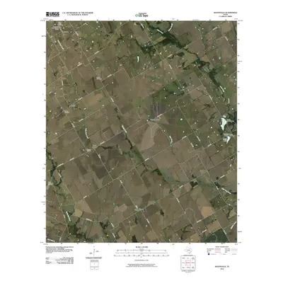
2010 Map of Westphalia
USGS Topo · Published 2010About this map
The Westphalia Rural Historic District anchors the northwestern corner of this landscape, reflecting the enduring agricultural roots of Falls County. This 2010 survey shows a network of rural settlements, including Westphalia, Barclay, Zipperlandville, and Wilson, connected by a web of county roads and farm-to-market routes like FM 1772. The area is notably rich in community landmarks, with Saint Marys Cemetery, Barclay Cemetery, and Saint Joseph Cemetery providing critical points of reference for local family history and genealogy.
Find a feature on this map
57 named features on this map. Tap any name to fly to it.
Don’t see what you’re looking for? This feature index may not catch every label — zoom into the map to look around manually.
Map Details
Editions of this 2010 Westphalia Map
This is the sole edition of this map. No revisions or reprints were ever made.
Other maps of this area

1885 · Taylor
USGS Topo · 1:125,000

1887 · Taylor
USGS Topo · 1:125,000

1892 · Temple
USGS Topo · 1:125,000

1894 · Taylor
USGS Topo · 1:125,000

1954 · Waco
USGS Topo · 1:250,000

1954 · Austin
USGS Topo · 1:250,000

1955 · Waco
USGS Topo · 1:250,000

1962 · Rosebud
USGS Topo · 1:24,000
1962 · Ben Arnold
USGS Topo · 1:24,000

1962 · Cedar Springs
USGS Topo · 1:24,000