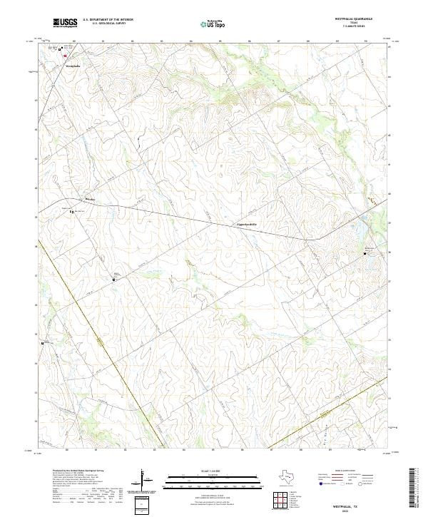
2022 Map of Westphalia
USGS Topo · Published 2022About this map
Westphalia anchors the northern reaches of this landscape, where the rural crossroads of Falls County meet a network of creek drainages and country roads. The settlement pattern is defined by small communities such as Barclay and the curiously named Zipperlandville, each connected by a grid of numbered roads that navigate the local topography. This area is notably dense with small family and parish burial grounds, including the dual Saint Marys Cem - West and Saint Marys Cem - East, as well as the Salem Lutheran Cem and Pieper Cem, which reflect the region's deep agricultural and immigrant roots.
Find a feature on this map
65 named features on this map. Tap any name to fly to it.
Don’t see what you’re looking for? This feature index may not catch every label — zoom into the map to look around manually.
Map Details
Editions of this 2022 Westphalia Map
This is the sole edition of this map. No revisions or reprints were ever made.
Other maps of this area

1885 · Taylor
USGS Topo · 1:125,000

1887 · Taylor
USGS Topo · 1:125,000

1892 · Temple
USGS Topo · 1:125,000

1894 · Taylor
USGS Topo · 1:125,000

1954 · Waco
USGS Topo · 1:250,000

1954 · Austin
USGS Topo · 1:250,000

1955 · Waco
USGS Topo · 1:250,000

1962 · Rosebud
USGS Topo · 1:24,000
1962 · Ben Arnold
USGS Topo · 1:24,000

1962 · Cedar Springs
USGS Topo · 1:24,000