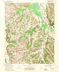
1969 Map of Westplains
USGS Topo · Published 1971About this map
Westplains and the surrounding agricultural lands of Graves County are defined by the winding course of the West Fork Clarks River and its broad Casey Bottoms. This late-1960s landscape shows a community structured by its waterways and small rural congregations, with numerous houses of worship including Shelton Chapel, Hopewell Church, and McKindree Ch dotting the countryside. The southern portion of the map is dominated by modern infrastructure, specifically the Purchase Parkway and the Mayfield Graves County Airport, which cut across the natural drainage patterns of the Tennessee Valley Divide. Smaller settlements like Clear Springs and Hicksville serve as local landmarks alongside various family-named water features such as Walker Riley Branch and Tucker Branch. The transition between historical crossings like the Old Casey Bridge and newer developments highlights the evolving transportation network of western Kentucky.
Find a feature on this map
36 named features on this map. Tap any name to fly to it.
Don’t see what you’re looking for? This feature index may not catch every label — zoom into the map to look around manually.
Map Details
Editions of this 1969 Westplains Map
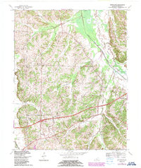
2 editions found
Other maps of this area

1936 · Farmington
USGS Topo · 1:24,000

1936 · Melber
USGS Topo · 1:24,000

1936 · Oak Level
USGS Topo · 1:24,000

1936 · Elva
USGS Topo · 1:24,000

1936 · Symsonia
USGS Topo · 1:24,000

1936 · Benton
USGS Topo · 1:48,000

1936 · Westplains
USGS Topo · 1:24,000

1936 · Kirksey
USGS Topo · 1:24,000

1951 · Kirksey
USGS Topo · 1:24,000

1951 · Farmington
USGS Topo · 1:24,000