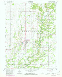
1958 Map of Westport
USGS Topo · Published 1981About this map
Westport serves as the primary hub of this southern Indiana landscape, situated near the intersection of the Old Railroad Grade and Sand Creek. The map reveals a deeply established rural network defined by its small settlements and numerous family and community landmarks, including Letts Corner, Rodney, and Gaynorsville. The terrain is significantly shaped by the winding paths of Panther Creek and Cobbs Creek, which carve through the countryside towards the Old Indian Treaty Bdy. A notable concentration of heritage sites exists around the town center, from the Westport Cem to the local Township Sch. Farther afield, specialized features like the Covered Bridge over the creek and the isolated Mt Aerie Ch indicate the local infrastructure of the mid-20th century. This survey records a period of agricultural stability and local transport before major modern highway expansions changed the rural character of the area.
Find a feature on this map
48 named features on this map. Tap any name to fly to it.
Don’t see what you’re looking for? This feature index may not catch every label — zoom into the map to look around manually.
Map Details
Editions of this 1958 Westport Map
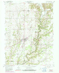
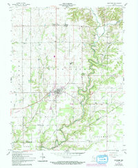
4 editions found
Other maps of this area

1942 · Columbus
USGS Topo · 1:125,000

1953 · Cincinnati
USGS Topo · 1:250,000

1957 · Cincinnati
USGS Topo · 1:250,000

1957 · Butlerville
USGS Topo · 1:24,000

1957 · North Vernon
USGS Topo · 1:24,000

1958 · Greensburg
USGS Topo · 1:24,000

1958 · Millhousen
USGS Topo · 1:24,000

1958 · Westport
USGS Topo · 1:24,000

1958 · Forest Hill
USGS Topo · 1:24,000

1958 · Hartsville
USGS Topo · 1:24,000