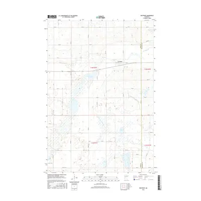
2016 Map of Westport
USGS Topo · Published 2016About this map
Westport sits at a geographic crossroads in the northern reaches of Pope County, where the landscape is defined by an intricate network of glacial lakes and drainage systems. This 2016 survey shows the community situated along Old Hwy 28, bordered to the south by the significant waters of Westport Lake. The surrounding prairie is dotted with numerous water bodies, including Swan Lake, Krantz Lake, and Lincoln Lake, reflecting the post-glacial topography of central Minnesota. The intricate hydrology of the region is further managed through engineering, as seen in the presence of County Ditch Number Eleven and County Ditch Number Six, which work in tandem with natural waterways like Ashley Creek. The map documents a predominantly rural and agricultural township structure, with a grid of township roads such as 150th St and 110th St providing access to the fertile land between these numerous lakes.
Find a feature on this map
41 named features on this map. Tap any name to fly to it.
Don’t see what you’re looking for? This feature index may not catch every label — zoom into the map to look around manually.
Map Details
Editions of this 2016 Westport Map
This is the sole edition of this map. No revisions or reprints were ever made.
Other maps of this area

1953 · Saint Cloud
USGS Topo · 1:250,000

1957 · Saint Cloud
USGS Topo · 1:250,000

1958 · Saint Cloud
USGS Topo · 1:250,000

1965 · Westport
USGS Topo · 1:24,000

1965 · Padua
USGS Topo · 1:24,000

1965 · Sedan
USGS Topo · 1:24,000

1965 · Raymond Lake
USGS Topo · 1:24,000

1966 · West Union
USGS Topo · 1:24,000

1966 · Osakis
USGS Topo · 1:24,000

1966 · Forada
USGS Topo · 1:24,000