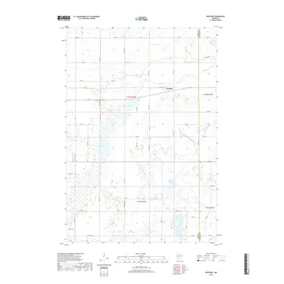
2019 Map of Westport
USGS Topo · Published 2019About this map
Westport sits at a geographic crossroads in this central Minnesota landscape, where the prairie meets an intricate network of wetlands and glacial lakes. The settlement is positioned near Westport Lake and the winding course of Ashley Cr, which flows eastward toward the Pope County and Stearns County line. The map reveals an area defined by agricultural management and natural hydrology, as seen in the engineered paths of County Ditch Number Six and County Ditch Number Eleven that drain the surrounding basins. This 2019 survey documents a rural environment where large bodies of water like Swan Lake and Lincoln Lake remain focal points of the terrain. The transition from older transport routes like Old Hwy 28 to the modern grid of township roads reflects the long-term settlement patterns of this lake-strewn region.
Find a feature on this map
36 named features on this map. Tap any name to fly to it.
Don’t see what you’re looking for? This feature index may not catch every label — zoom into the map to look around manually.
Map Details
Editions of this 2019 Westport Map
This is the sole edition of this map. No revisions or reprints were ever made.
Other maps of this area

1953 · Saint Cloud
USGS Topo · 1:250,000

1957 · Saint Cloud
USGS Topo · 1:250,000

1958 · Saint Cloud
USGS Topo · 1:250,000

1965 · Westport
USGS Topo · 1:24,000

1965 · Padua
USGS Topo · 1:24,000

1965 · Sedan
USGS Topo · 1:24,000

1965 · Raymond Lake
USGS Topo · 1:24,000

1966 · West Union
USGS Topo · 1:24,000

1966 · Osakis
USGS Topo · 1:24,000

1966 · Forada
USGS Topo · 1:24,000