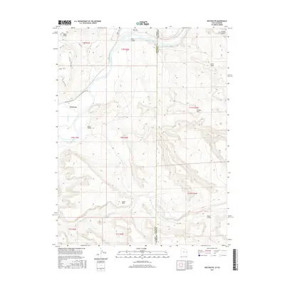
2017 Map of Westwater
USGS Topo · Published 2017About this map
The Colorado River carves a deep path through the desert landscape of the Utah-Colorado border, creating the dramatic geological formations of Ruby Canyon. This 2017 survey captures the high-desert environment around the small settlement of Westwater, located near the confluence of Westwater Cr and the river. The terrain is defined by its massive, flat-topped features including Western Mesa, Wrigley Mesa, and Snyder Mesa, which dominate the eastern and western horizons. Transportation in this arid region remains sparse, centered on access points like Boat Launch Rd and the Westwater Ranch Rd. To the south, the Little Dolores River winds through the canyons, while the northern reaches open into the Grand Valley. This map illustrates the intersection of several distinct drainage systems, including Bitter Cr and Knowles Canyon, highlighting how water has shaped the high mesas over millennia.
Find a feature on this map
29 named features on this map. Tap any name to fly to it.
Don’t see what you’re looking for? This feature index may not catch every label — zoom into the map to look around manually.
Map Details
Editions of this 2017 Westwater Map
This is the sole edition of this map. No revisions or reprints were ever made.
Other maps of this area

1885 · East Tavaputs
USGS Topo · 1:250,000

1885 · La Sal
USGS Topo · 1:250,000

1954 · Westwater 4 SW
USGS Topo · 1:24,000

1954 · Mt. Waas 1 NE
USGS Topo · 1:24,000

1954 · Mt. Waas 1 NW
USGS Topo · 1:24,000

1954 · Coates Creek
USGS Topo · 1:62,500

1956 · Westwater 4 SE
USGS Topo · 1:24,000

1956 · Moab
USGS Topo · 1:250,000

1956 · Grand Junction
USGS Topo · 1:250,000

1959 · Grand Junction
USGS Topo · 1:250,000