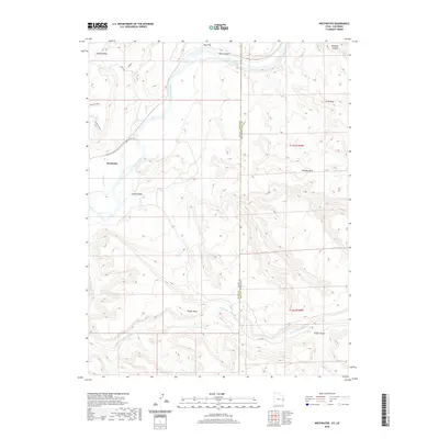
2020 Map of Westwater
USGS Topo · Published 2020About this map
The Colorado River carves through the heart of this landscape, marking the rugged transition between the Grand Valley and the high desert plateaus of the Utah-Colorado border. Near the settlement of Westwater, the river enters the dramatic narrows of Ruby Canyon, a key corridor for both natural drainage and modern transport. The map reveals a network of high-elevation features such as Western Mesa, Wrigley Mesa, and Snyder Mesa, which define the verticality of the terrain. To the south, the Little Dolores River and Kings Canyon provide deep relief to the plateau surface. Access to the river is noted via Boat Launch Rd and Westwater Ranch Rd, highlighting the area's importance for river transit and ranching. The border between Grand County, Utah, and Mesa County, Colorado, splits the survey, documenting how political boundaries bisect this contiguous geologic environment.
Find a feature on this map
23 named features on this map. Tap any name to fly to it.
Don’t see what you’re looking for? This feature index may not catch every label — zoom into the map to look around manually.
Map Details
Editions of this 2020 Westwater Map
This is the sole edition of this map. No revisions or reprints were ever made.
Other maps of this area

1885 · East Tavaputs
USGS Topo · 1:250,000

1885 · La Sal
USGS Topo · 1:250,000

1954 · Westwater 4 SW
USGS Topo · 1:24,000

1954 · Mt. Waas 1 NE
USGS Topo · 1:24,000

1954 · Mt. Waas 1 NW
USGS Topo · 1:24,000

1954 · Coates Creek
USGS Topo · 1:62,500

1956 · Westwater 4 SE
USGS Topo · 1:24,000

1956 · Moab
USGS Topo · 1:250,000

1956 · Grand Junction
USGS Topo · 1:250,000

1959 · Grand Junction
USGS Topo · 1:250,000