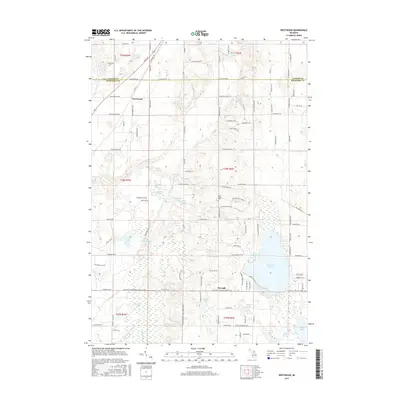
2017 Map of Westwood
USGS Topo · Published 2017About this map
Westwood and Darragh sit within a landscape defined by an intricate network of glacial lakes and wetlands along the border of Antrim and Kalkaska counties. The topography is dominated by water, from the expansive Manistee Lake in the southeast to the source waters of the Boardman River and Rapid River. These waterways provided the foundation for early settlement and seasonal camps, with the terrain ranging from the dense Mahan Swamp to the clusters of smaller basins like Peters Lake, Davis Lake, and Rainbow Lake. Cultural markers like the Cold Spring Cem and historical transit routes like Mackinac Trl offer a look into the long-standing community structure of this pocket of Northern Michigan. The map reveals a high density of named water bodies, including Little Wheeler Lake and Lake of the Woods, reflecting the region's legacy as a destination for outdoor recreation and local residence.
Find a feature on this map
117 named features on this map. Tap any name to fly to it.
Don’t see what you’re looking for? This feature index may not catch every label — zoom into the map to look around manually.
Map Details
Editions of this 2017 Westwood Map
This is the sole edition of this map. No revisions or reprints were ever made.
Other maps of this area

1949 · Black Creek
USGS Topo · 1:24,000

1949 · Fletcher
USGS Topo · 1:62,500

1954 · Traverse City
USGS Topo · 1:250,000

1956 · Alba
USGS Topo · 1:62,500

1956 · Mancelona
USGS Topo · 1:62,500

1956 · Kalkaska
USGS Topo · 1:62,500

1958 · Traverse City
USGS Topo · 1:250,000

1975 · Mancelona NE
USGS Topo · 1:24,000

1975 · Mancelona NW
USGS Topo · 1:24,000

1983 · Traverse City
USGS Topo · 1:100,000