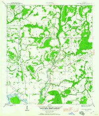
1945 Map of Wetappo Creek
USGS Topo · Published 1960About this map
Wetappo Creek and its complex network of tributaries define this low-lying Gulf County landscape as it appeared during the mid-1940s. The area is dominated by extensive wetland systems, including Bill Swamp to the north and the sprawling Brushy Creek Swamp to the south. A notable human footprint in this saturated environment is the Wetappo Side Camp, situated along the winding course of the creek.
Find a feature on this map
14 named features on this map. Tap any name to fly to it.
Don’t see what you’re looking for? This feature index may not catch every label — zoom into the map to look around manually.
Map Details
Editions of this 1945 Wetappo Creek Map
4 editions found
Other maps of this area

1943 · Overstreet
USGS Topo · 1:31,680

1944 · Beacon Hill
USGS Topo · 1:31,680

1944 · White City
USGS Topo · 1:24,000

1945 · Dead Lake
USGS Topo · 1:31,680

1945 · White City
USGS Topo · 1:31,680

1945 · Allanton
USGS Topo · 1:31,680

1945 · North Of Allanton
USGS Topo · 1:31,680

1945 · Wewahitchka
USGS Topo · 1:31,680

1945 · Wetappo Creek
USGS Topo · 1:31,680

1945 · Tenmile Swamp
USGS Topo · 1:31,680