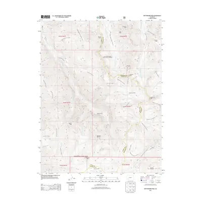
2013 Map of Wetterhorn Peak
USGS Topo · Published 2013About this map
Wetterhorn Peak and the surrounding high country of the Uncompahgre National Forest dominate this 2013 survey of the San Juan Mountains. Spanning the boundary of Ouray and Hinsdale counties, the landscape is defined by its drainage systems and glacial features, including the W Fork Cimarron River and Middle Fork Cimarron River. The map illustrates a complex network of named mountain trails used by generations of climbers and packers, such as the Wetterhorn Peak Trl 9256.0 and the Ridge Stock Driveway Trl 9233.0. Notable high-altitude landmarks include the American Flats plateau and the prominent Coxcomb Peak. This record serves as a comprehensive guide to the physical geography of one of Colorado's most demanding alpine regions, documenting the location of peaks like Sunshine Mountain and Blackwall Mountain alongside water sources like American Lake.
Find a feature on this map
52 named features on this map. Tap any name to fly to it.
Don’t see what you’re looking for? This feature index may not catch every label — zoom into the map to look around manually.
Map Details
Editions of this 2013 Wetterhorn Peak Map
This is the sole edition of this map. No revisions or reprints were ever made.
Other maps of this area

1897 · Silverton
USGS Topo · 1:62,500

1901 · Silverton
USGS Topo · 1:62,500

1902 · Silverton
USGS Topo · 1:62,500

1902 · Ouray
USGS Topo · 1:62,500

1903 · Lake City
USGS Topo · 1:62,500

1904 · Ouray
USGS Topo · 1:62,500

1905 · Lake City
USGS Topo · 1:62,500

1905 · San Cristobal
USGS Topo · 1:125,000

1907 · San Cristobal
USGS Topo · 1:125,000

1908 · Uncompahgre
USGS Topo · 1:125,000