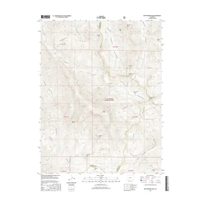
2016 Map of Wetterhorn Peak
USGS Topo · Published 2016About this map
Wetterhorn Peak and the high ridges of the Uncompahgre National Forest dominate this 2016 survey of the San Juan Mountains boundary between Ouray and Hinsdale counties. The landscape is defined by its drainages and trekking routes rather than roads, as the W Fork Cimarron River, Henson Cr, and Cow Cr carve deep paths through the alpine terrain. Hikers and researchers can trace the high-altitude American Flats near Wildhorse Peak and the complex network of pack trails, including the Horsethief Trail and Difficulty Creek Trail, which navigate the steep elevations near Sunshine Mtn and Blackwall Mtn. This map captures a specific moment in the management of these public lands, showing the detailed intersection of natural landmarks like Pinnacle Ridge and Porphyry Basin with the established trail systems used by modern wilderness travelers.
Find a feature on this map
50 named features on this map. Tap any name to fly to it.
Don’t see what you’re looking for? This feature index may not catch every label — zoom into the map to look around manually.
Map Details
Editions of this 2016 Wetterhorn Peak Map
This is the sole edition of this map. No revisions or reprints were ever made.
Other maps of this area

1897 · Silverton
USGS Topo · 1:62,500

1901 · Silverton
USGS Topo · 1:62,500

1902 · Silverton
USGS Topo · 1:62,500

1902 · Ouray
USGS Topo · 1:62,500

1903 · Lake City
USGS Topo · 1:62,500

1904 · Ouray
USGS Topo · 1:62,500

1905 · Lake City
USGS Topo · 1:62,500

1905 · San Cristobal
USGS Topo · 1:125,000

1907 · San Cristobal
USGS Topo · 1:125,000

1908 · Uncompahgre
USGS Topo · 1:125,000