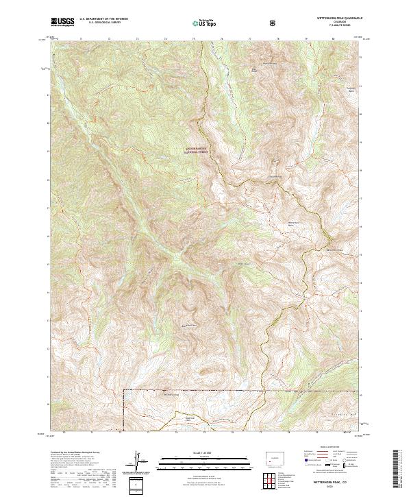
2022 Map of Wetterhorn Peak
USGS Topo · Published 2022About this map
Uncompahgre National Forest encompasses the high-altitude terrain of the San Juan Mountains in this modern survey of the Ouray and Hinsdale county border. The landscape is defined by massive peaks including Wetterhorn Peak and Coxcomb Peak, providing a clear look at the drainage patterns of the W Fork Cimarron River, Middle Fork Cimarron River, and E Fork Cimarron River. The convergence of these headwaters below Precipice Peak and Redcliff illustrates the complex topography that historically challenged alpine travel.
Find a feature on this map
51 named features on this map. Tap any name to fly to it.
Don’t see what you’re looking for? This feature index may not catch every label — zoom into the map to look around manually.
Map Details
Editions of this 2022 Wetterhorn Peak Map
This is the sole edition of this map. No revisions or reprints were ever made.
Other maps of this area

1897 · Silverton
USGS Topo · 1:62,500

1901 · Silverton
USGS Topo · 1:62,500

1902 · Silverton
USGS Topo · 1:62,500

1902 · Ouray
USGS Topo · 1:62,500

1903 · Lake City
USGS Topo · 1:62,500

1904 · Ouray
USGS Topo · 1:62,500

1905 · Lake City
USGS Topo · 1:62,500

1905 · San Cristobal
USGS Topo · 1:125,000

1907 · San Cristobal
USGS Topo · 1:125,000

1908 · Uncompahgre
USGS Topo · 1:125,000