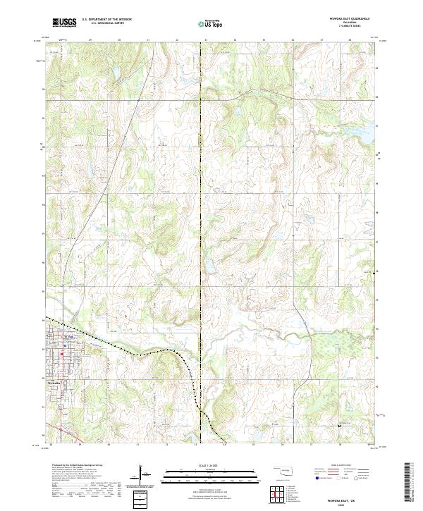
2022 Map of Wewoka East
USGS Topo · Published 2022About this map
Wewoka serves as the focal point for this 2022 survey, with the Seminole County Courthouse anchoring the western edge of the map. The landscape is defined by the winding course of Wewoka Creek and its various tributaries, including Jacobs Cr and Tiger Cr. For researchers, the map provides precise locations for burial grounds like Harjo Cem and McCaybe Cem, which are tucked away from the main road networks.
Find a feature on this map
44 named features on this map. Tap any name to fly to it.
Don’t see what you’re looking for? This feature index may not catch every label — zoom into the map to look around manually.
Map Details
Editions of this 2022 Wewoka East Map
This is the sole edition of this map. No revisions or reprints were ever made.
Other maps of this area

1896 · Seminole and Prague
USGS Topo · 1:125,000

1900 · Wewoka
USGS Topo · 1:125,000

1954 · Oklahoma City
USGS Topo · 1:250,000

1957 · Oklahoma City
USGS Topo · 1:250,000

1963 · Oklahoma City
USGS Topo · 1:250,000

1967 · Cromwell
USGS Topo · 1:24,000

1967 · Okemah SE
USGS Topo · 1:24,000

1967 · Prague SE
USGS Topo · 1:24,000
1972 · Wewoka West
USGS Topo · 1:24,000
1972 · Wewoka East
USGS Topo · 1:24,000