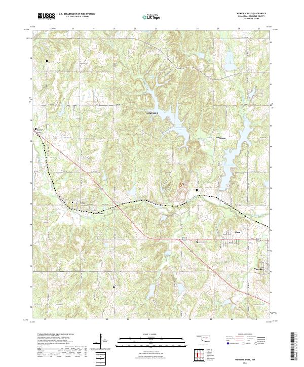
2022 Map of Wewoka West
USGS Topo · Published 2022About this map
Wewoka Cr and its tributaries define the rolling landscape of this Oklahoma territory, where small communities like Lima and New Lima are linked by a dense network of sectional roads. The map reveals a pattern of local history preserved in numerous burial grounds, including Lima Cem, Sciplo Cem, and the Westwood Cem north of Wewoka. The presence of several large water bodies such as Sportsman Lake, Wewoka Lake, and Danielson Lake reflects the mid-century development of the region's water resources for recreation and conservation. These reservoirs, along with Tiger Cr and Coon Cr, suggest a shift in the local economy toward recreation alongside the traditional rural settlements of Nobletown and Dixon.
Find a feature on this map
83 named features on this map. Tap any name to fly to it.
Don’t see what you’re looking for? This feature index may not catch every label — zoom into the map to look around manually.
Map Details
Editions of this 2022 Wewoka West Map
This is the sole edition of this map. No revisions or reprints were ever made.
Other maps of this area

1896 · Seminole and Prague
USGS Topo · 1:125,000

1900 · Wewoka
USGS Topo · 1:125,000

1954 · Oklahoma City
USGS Topo · 1:250,000

1957 · Oklahoma City
USGS Topo · 1:250,000

1963 · Oklahoma City
USGS Topo · 1:250,000

1967 · Cromwell
USGS Topo · 1:24,000

1967 · Prague SW
USGS Topo · 1:24,000

1967 · Prague SE
USGS Topo · 1:24,000
1972 · Seminole
USGS Topo · 1:24,000
1972 · Wewoka West
USGS Topo · 1:24,000