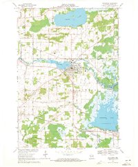
1969 Map of Weyauwega
USGS Topo · Published 1971About this map
Weyauwega serves as the focal point of this late 1960s survey, situated where the Waupaca River widens into Weyauwega Lake. The town's layout includes civic landmarks like the Waupaca County Fairground and the Waupaca County Hospital, while the Soo Line railroad provides a clear industrial corridor through the township. To the east, the landscape transitions into the expansive wetlands of Partridge Lake and the winding Wolf River, where Gills Landing and Decker Memorial County Park mark important river access points.
Find a feature on this map
56 named features on this map. Tap any name to fly to it.
Don’t see what you’re looking for? This feature index may not catch every label — zoom into the map to look around manually.
Map Details
Editions of this 1969 Weyauwega Map
2 editions found
Other maps of this area

1955 · Green Bay
USGS Topo · 1:250,000

1956 · Weyauwega
USGS Topo · 1:48,000

1957 · Waupaca
USGS Topo · 1:48,000

1961 · Poy Sippi
USGS Topo · 1:62,500

1961 · Redgranite
USGS Topo · 1:62,500

1961 · Saxeville
USGS Topo · 1:24,000

1961 · Lake Poygan
USGS Topo · 1:24,000
1961 · Poy Sippi
USGS Topo · 1:24,000

1969 · Readfield
USGS Topo · 1:24,000

1969 · Northport
USGS Topo · 1:24,000