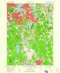
1958 Map of Weymouth
USGS Topo · Published 1960About this map
The U S Naval Reservation South Weymouth Air Station dominates the southern landscape of this 1950s survey, illustrating the significant military footprint in Norfolk County during the Cold War. In Weymouth, the dense residential patterns of North Weymouth, East Weymouth, and South Weymouth are clearly visible, punctuated by local landmarks like Whitmans Pond and the Jefferson School. To the east, Hingham retains a more open character with features such as World's End and Baker Hill overlooking Hingham Harbor. The rail-centered commerce of the era is evident along the New York New Haven and Hartford railroad line, which connects established centers like Braintree and North Abington. From the tidal flats of Mill Cove to the cemeteries of Fairmount Cemetery and St Pauls Cem, the map documents the post-war suburbanization and industrial character of the Massachusetts South Shore.
Find a feature on this map
120 named features on this map. Tap any name to fly to it.
Don’t see what you’re looking for? This feature index may not catch every label — zoom into the map to look around manually.
Map Details
Editions of this 1958 Weymouth Map
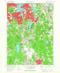
2 editions found
Other maps of this area

1885 · Abington
USGS Topo · 1:62,500

1886 · Dedham
USGS Topo · 1:62,500

1888 · Abington
USGS Topo · 1:62,500

1892 · Boston Bay
USGS Topo · 1:62,500

1893 · Abington
USGS Topo · 1:62,500

1893 · Boston
USGS Topo · 1:62,500

1894 · Dedham
USGS Topo · 1:62,500

1903 · Boston
USGS Topo · 1:62,500

1903 · Boston Bay
USGS Topo · 1:62,500

1919 · Dedham
USGS Topo · 1:62,500