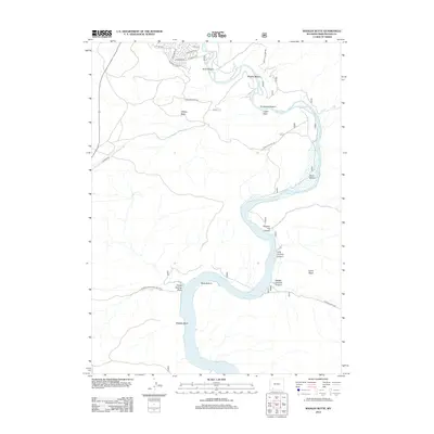
2012 Map of Whalen Butte
USGS Topo · Published 2012About this map
The Green River flows through a series of pronounced alluvial bends and narrow canyons in this 2012 survey of Sweetwater County. The northern reach is characterized by distinct river bottoms such as Scott Bottom, Whalen Bottom, and Cordwood Bottom, while the southern portion of the map is dominated by the expanding waters of the Flaming Gorge Reservoir. This transition from a traditional river channel to a massive impoundment within the Flaming Gorge Natl Rec Area illustrates the managed hydrology of the Upper Colorado River Basin.
Find a feature on this map
30 named features on this map. Tap any name to fly to it.
Don’t see what you’re looking for? This feature index may not catch every label — zoom into the map to look around manually.
Map Details
Editions of this 2012 Whalen Butte Map
This is the sole edition of this map. No revisions or reprints were ever made.
Other maps of this area

1954 · Rock Springs
USGS Topo · 1:250,000

1957 · Mc Kinnon Junction
USGS Topo · 1:62,500

1957 · Firehole Basin
USGS Topo · 1:62,500

1958 · Rock Springs
USGS Topo · 1:250,000

1961 · Peru
USGS Topo · 1:24,000

1961 · Kanda
USGS Topo · 1:24,000

1961 · Green River
USGS Topo · 1:24,000

1962 · Rock Springs
USGS Topo · 1:250,000

1966 · Firehole Basin
USGS Topo · 1:62,500

1966 · Mc Kinnon Junction
USGS Topo · 1:62,500