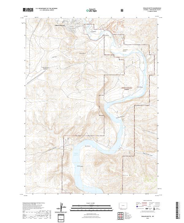
2021 Map of Whalen Butte
USGS Topo · Published 2021About this map
Green River borders the northern edge of this landscape, where the town's residential streets, such as Pennsylvania Blvd and California Dr, give way to the dramatic topography of the Wyoming high desert. The terrain is defined by the winding course of the river through a series of fertile basins including Scott Bottom, Whalen Bottom, and Davis Bottom. To the south, the waters of the Flaming Gorge Reservoir fill the deep canyons, backed by the high rising slopes of Flattop Mtn. This area transitions from the urban outskirts of the county seat into the protected lands of the Ashley National Forest. One of the most distinctive modern landmarks is the Greater Green River Intergalactic Spaceport, located on the plateau near Logan Draw. A network of recreational paths like the 10 Ring Trl and Quickdraw Trl weave through the draws and canyons above Slippery Jim Canyon.
Find a feature on this map
40 named features on this map. Tap any name to fly to it.
Don’t see what you’re looking for? This feature index may not catch every label — zoom into the map to look around manually.
Map Details
Editions of this 2021 Whalen Butte Map
This is the sole edition of this map. No revisions or reprints were ever made.
Other maps of this area

1954 · Rock Springs
USGS Topo · 1:250,000

1957 · Mc Kinnon Junction
USGS Topo · 1:62,500

1957 · Firehole Basin
USGS Topo · 1:62,500

1958 · Rock Springs
USGS Topo · 1:250,000

1961 · Peru
USGS Topo · 1:24,000

1961 · Kanda
USGS Topo · 1:24,000

1961 · Green River
USGS Topo · 1:24,000

1962 · Rock Springs
USGS Topo · 1:250,000

1966 · Firehole Basin
USGS Topo · 1:62,500

1966 · Mc Kinnon Junction
USGS Topo · 1:62,500