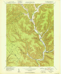
1950 Map of Wharton
USGS Topo · Published 1950About this map
Austin and the neighboring settlements of Costello and Wharton anchor this mid-century topographic record of the Potter County landscape. The topography is dominated by the steep drainages of the First Fork Sinnemahoning Creek and its many tributaries, including Portage Creek and Bailey Run. Small-scale evidence of the region's industrial and social past is preserved in labels like Railroad Hol and the Splash Dam located along Bailey Run, reflecting the area's history of timber transport and rail. Local genealogy is well-supported by numerous marked burial sites such as St Joseph Cem, Forest Hill Cem, and Wharton Cem, alongside the Reesville Sch. The map also captures the intricate network of hollows and ridges, such as Kirkendahl Hol and Big Carlson Hol, which define the remote character of this Pennsylvania State Forest region.
Find a feature on this map
67 named features on this map. Tap any name to fly to it.
Don’t see what you’re looking for? This feature index may not catch every label — zoom into the map to look around manually.
Map Details
Editions of this 1950 Wharton Map
2 editions found
Other maps of this area

1945 · Driftwood
USGS Topo · 1:48,000

1945 · First Fork
USGS Topo · 1:24,000

1945 · Cameron
USGS Topo · 1:24,000

1946 · Renovo West
USGS Topo · 1:62,500

1946 · Hammersley Fork
USGS Topo · 1:24,000

1947 · Cameron
USGS Topo · 1:24,000

1947 · First Fork
USGS Topo · 1:24,000

1947 · Conrad
USGS Topo · 1:62,500

1947 · Conrad
USGS Topo · 1:24,000

1947 · Ayers Hill
USGS Topo · 1:24,000