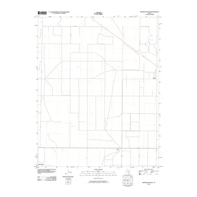
2010 Map of Wharton Ranch
USGS Topo · Published 2010About this map
Wharton Ranch and the subtle rise of Bunker Hill define this corner of the Texas Panhandle during the early 21st century. The landscape is structured by a rigorous grid of rural roads, including Bezner Ln, Barth Rd, and Telephone Rd, which reflect the large-scale agricultural and ranching operations characteristic of Dallam County. These straight-line thoroughfares contrast with the meandering path of Carrizo Creek, which cuts through the southwestern section of the quadrangle. The network of roads like Ranch Rd 1879 and Gandy Rd illustrates the modern infrastructure supporting this isolated ranching territory, where water sources and elevation points like the hill at the southern edge remain the primary landmarks in an otherwise open expanse.
Find a feature on this map
9 named features on this map. Tap any name to fly to it.
Don’t see what you’re looking for? This feature index may not catch every label — zoom into the map to look around manually.
Map Details
Editions of this 2010 Wharton Ranch Map
This is the sole edition of this map. No revisions or reprints were ever made.
Other maps of this area

1954 · Dalhart
USGS Topo · 1:250,000

1958 · Dalhart
USGS Topo · 1:250,000

1962 · Dalhart
USGS Topo · 1:250,000

1973 · Wharton Ranch
USGS Topo · 1:24,000

1973 · Tovrea Ranch
USGS Topo · 1:24,000

1973 · Corlena
USGS Topo · 1:24,000

1973 · Perico
USGS Topo · 1:24,000

1973 · Canyon School
USGS Topo · 1:24,000
1973 · Windy Hill
USGS Topo · 1:24,000

1973 · Bolin
USGS Topo · 1:24,000