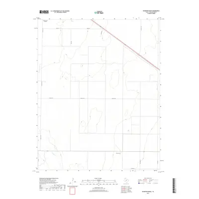
2019 Map of Wharton Ranch
USGS Topo · Published 2019About this map
Wharton Ranch serves as a focal point in this northwestern corner of the Texas Panhandle, where the high plains landscape is defined by large-scale ranching and agriculture. The terrain is marked by the drainage of Carrizo Cr in the southwest, one of the few natural hydrological features in this arid region. Transportation and logistics for these expansive operations are facilitated by a grid of named rural routes such as Bezner Ln, Barth Rd, and Walters Rd. A notable piece of specialized infrastructure is the Nebtex Land Co Airport in the northwest, suggesting the importance of aerial access for managing isolated ranching properties. The network of roads, including Telephone Rd and Ranch Rd 102, illustrates the transition from traditional land use to modern industrial ranching systems at the edge of Dallam County.
Find a feature on this map
13 named features on this map. Tap any name to fly to it.
Don’t see what you’re looking for? This feature index may not catch every label — zoom into the map to look around manually.
Map Details
Editions of this 2019 Wharton Ranch Map
This is the sole edition of this map. No revisions or reprints were ever made.
Other maps of this area

1954 · Dalhart
USGS Topo · 1:250,000

1958 · Dalhart
USGS Topo · 1:250,000

1962 · Dalhart
USGS Topo · 1:250,000

1973 · Wharton Ranch
USGS Topo · 1:24,000

1973 · Tovrea Ranch
USGS Topo · 1:24,000

1973 · Corlena
USGS Topo · 1:24,000

1973 · Perico
USGS Topo · 1:24,000

1973 · Canyon School
USGS Topo · 1:24,000
1973 · Windy Hill
USGS Topo · 1:24,000

1973 · Bolin
USGS Topo · 1:24,000