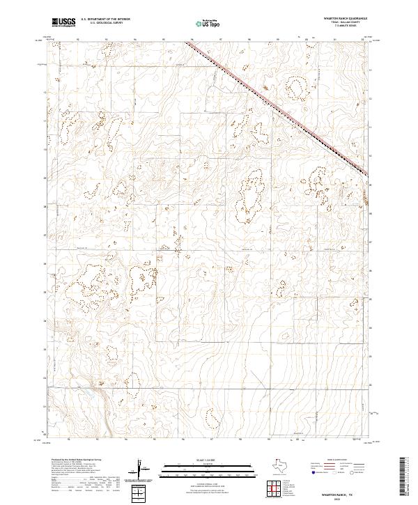
2022 Map of Wharton Ranch
USGS Topo · Published 2022About this map
The High Plains of Dallam County are defined by a grid of agricultural and ranching access roads, centered around the Wharton Ln area. Carrizo Cr meanders through the southern portion of the quadrangle, representing the primary drainage in this semi-arid landscape. The network of roads, including Bezner Ln, Barth Rd, and Walters Rd, indicates a region organized for large-scale livestock operations and farming near the Texas-New Mexico border. These named routes often reflect the local families and early settlers who established the region's agricultural footprint. While primarily open country, the intersection of routes like Telephone Rd and Ranch Rd 3110 highlights the infrastructure required to manage these extensive ranching lands.
Find a feature on this map
11 named features on this map. Tap any name to fly to it.
Don’t see what you’re looking for? This feature index may not catch every label — zoom into the map to look around manually.
Map Details
Editions of this 2022 Wharton Ranch Map
This is the sole edition of this map. No revisions or reprints were ever made.
Other maps of this area

1954 · Dalhart
USGS Topo · 1:250,000

1958 · Dalhart
USGS Topo · 1:250,000

1962 · Dalhart
USGS Topo · 1:250,000

1973 · Wharton Ranch
USGS Topo · 1:24,000

1973 · Tovrea Ranch
USGS Topo · 1:24,000

1973 · Corlena
USGS Topo · 1:24,000

1973 · Perico
USGS Topo · 1:24,000

1973 · Canyon School
USGS Topo · 1:24,000
1973 · Windy Hill
USGS Topo · 1:24,000

1973 · Bolin
USGS Topo · 1:24,000